Links to our neighbouring Local Geology Groups
Local Geology

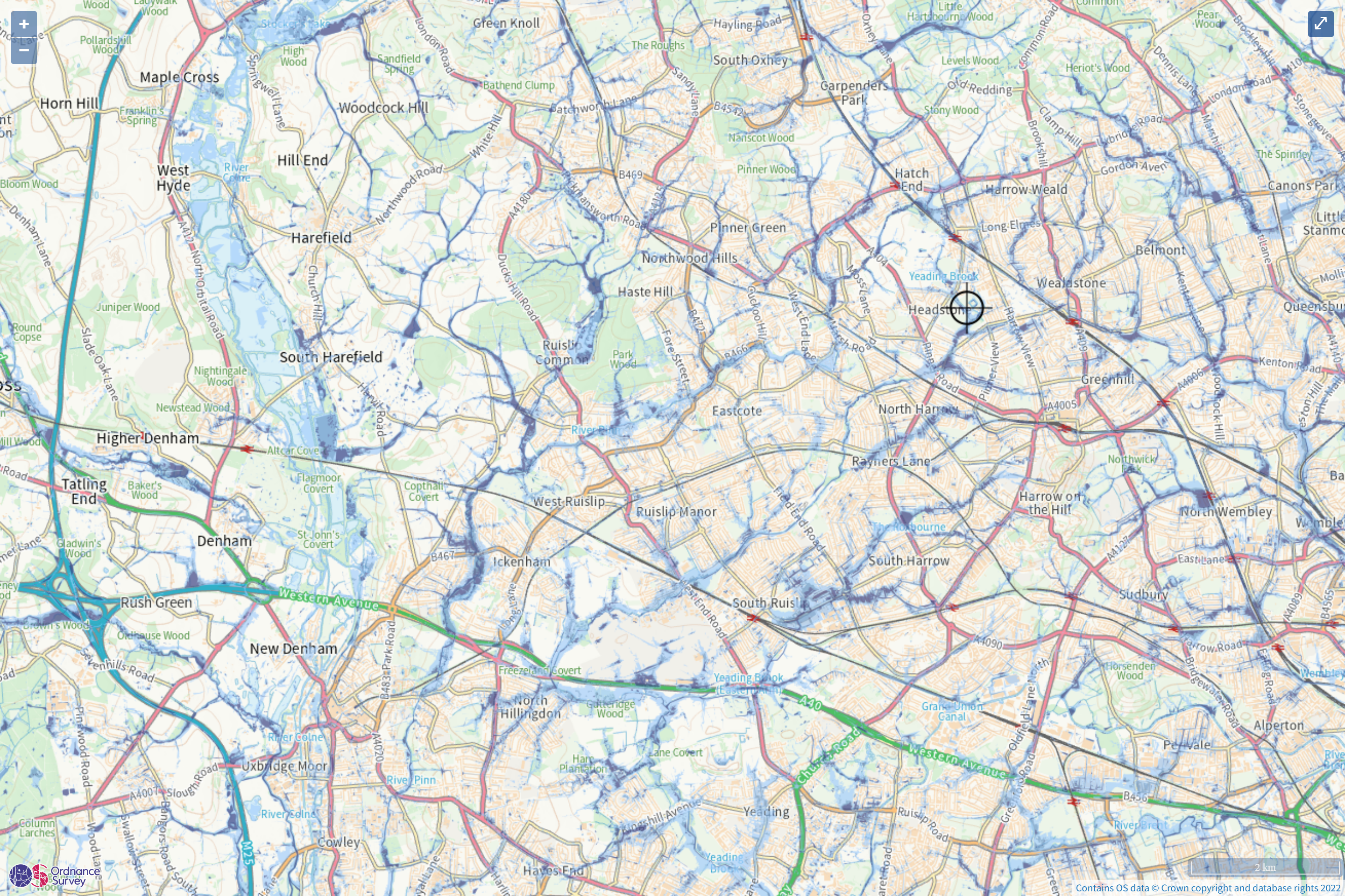
The London boroughs of Harrow and Hillingdon are situated in the London Basin, close the Chiltern Hills and sharing borders with Hertfordshire and Buckinghamshire.
Together they make up the northwestern part of Greater London and are predominantly suburban, with buildings concealing much of the landscape. On this webpage we will explore some of the surface features that offer a window into our local geology: rivers, hills, quarries, sarsens, chalk, flint, gravel.
Geological Sites of Special Scientific Interest (SSSI) (see Local SSSIs) (see section below on Geodiversity)
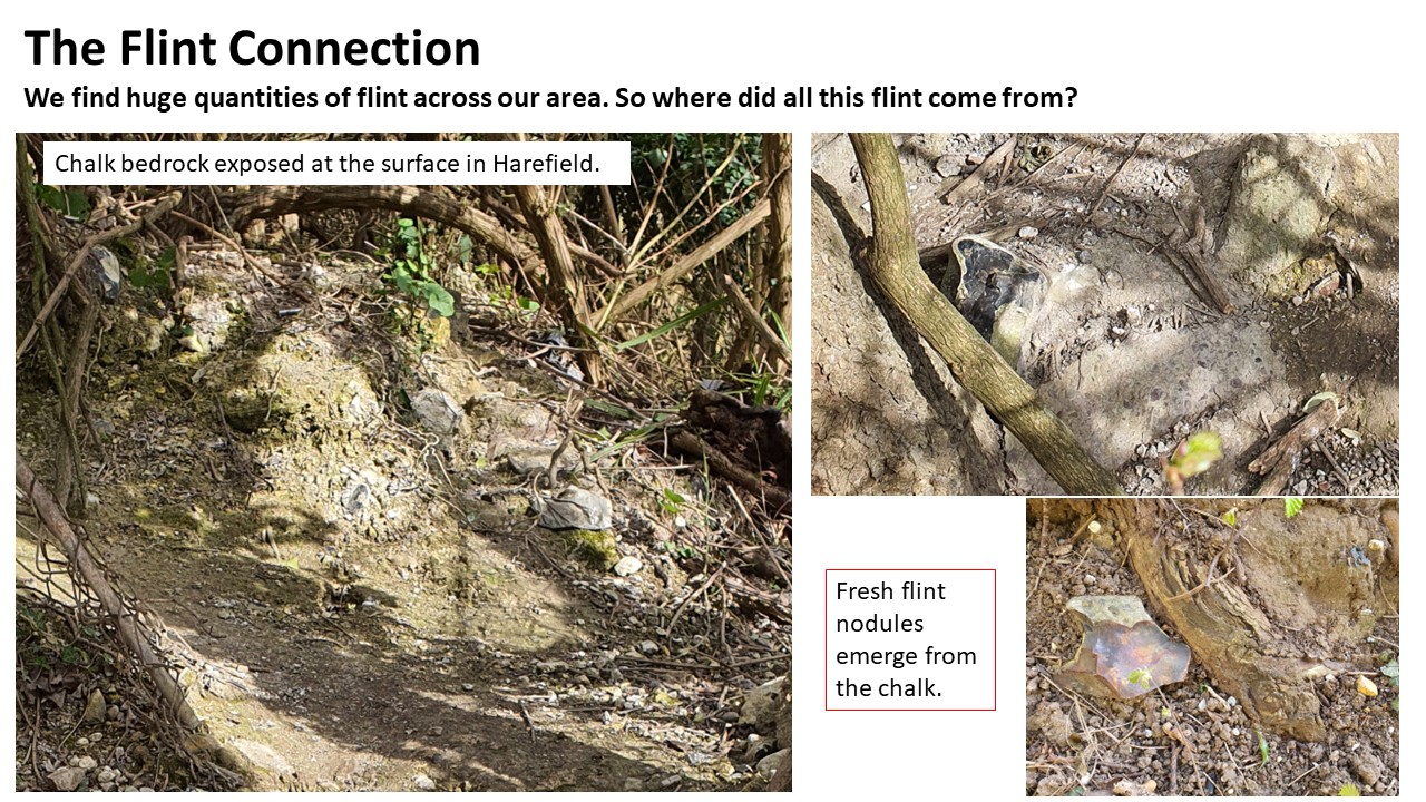
Harefield Pit (GLA 34), on the western margin of Hillingdon. A former chalk quarry with important outcrops of the Lambeth Group: Upnor Formation and the Thames Group: Harwich Formation
Harrow Weald (GLA 18) on the northern margin of Harrow. Important for its exposure of Pleistocene gravel beds above the Claygate Beds, the youngest layer of London Clay (see Stanmore Gravel Project)

Our area has a high concentration of SSSIs important for biodiversity, underpinned by the local geology:
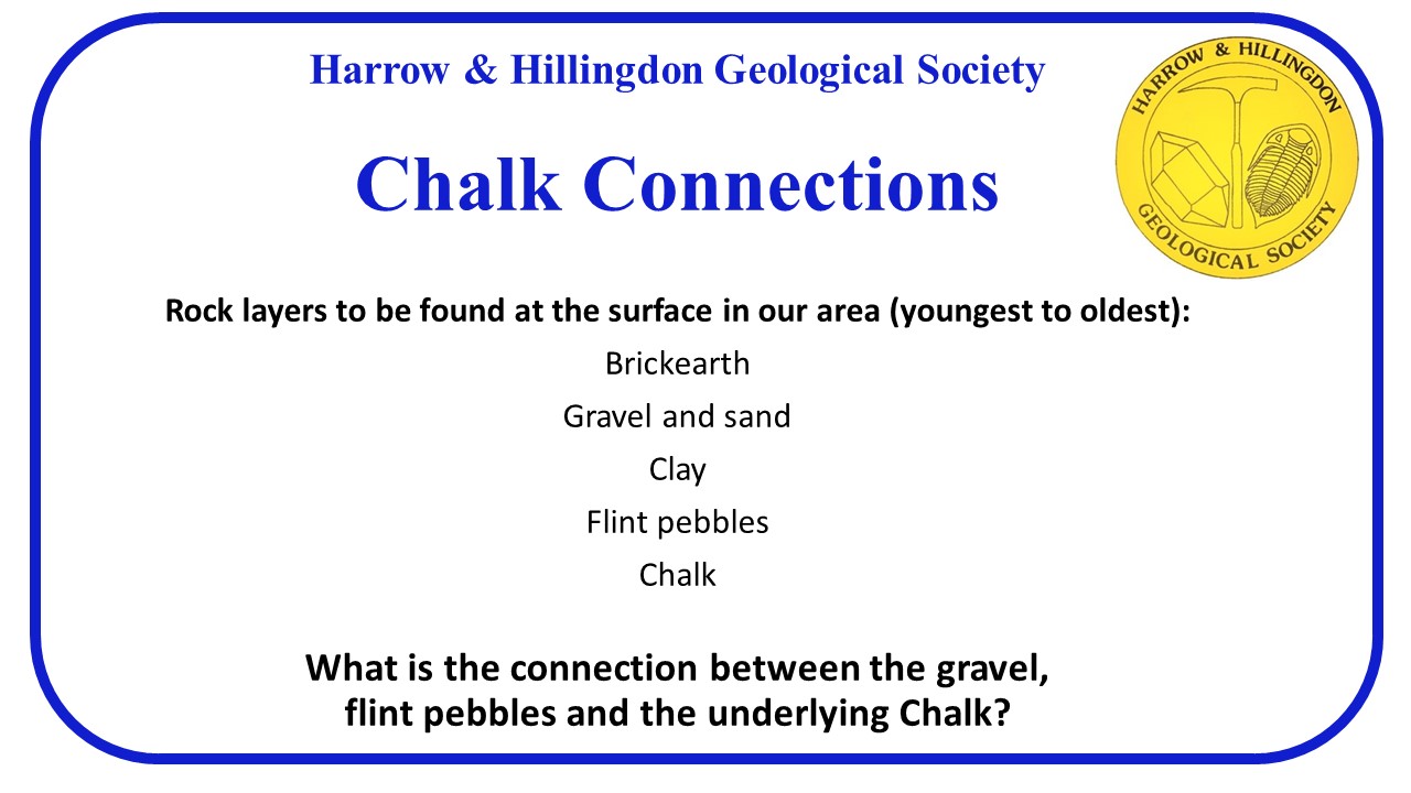
  • Chalk appears at or near the surface in various locations - it is a soil conditioner, reducing acidity
  • The area is covered with clay, silt, sand and gravel allowing ancient woodlands to thrive
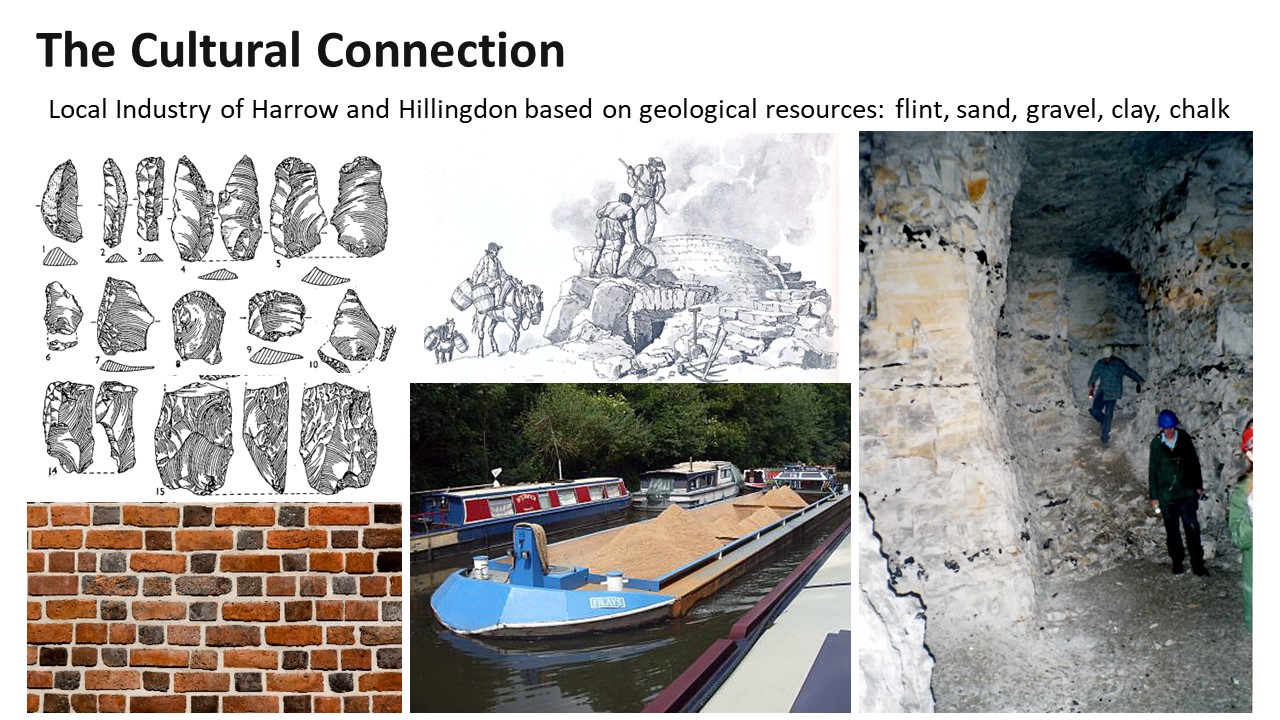
  • Flint including large boulders freshly emerging from the challk was essential to early human occupation
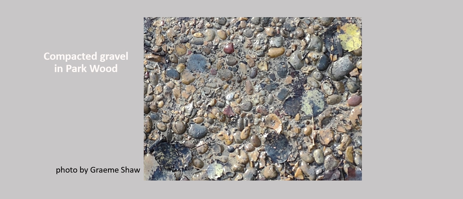
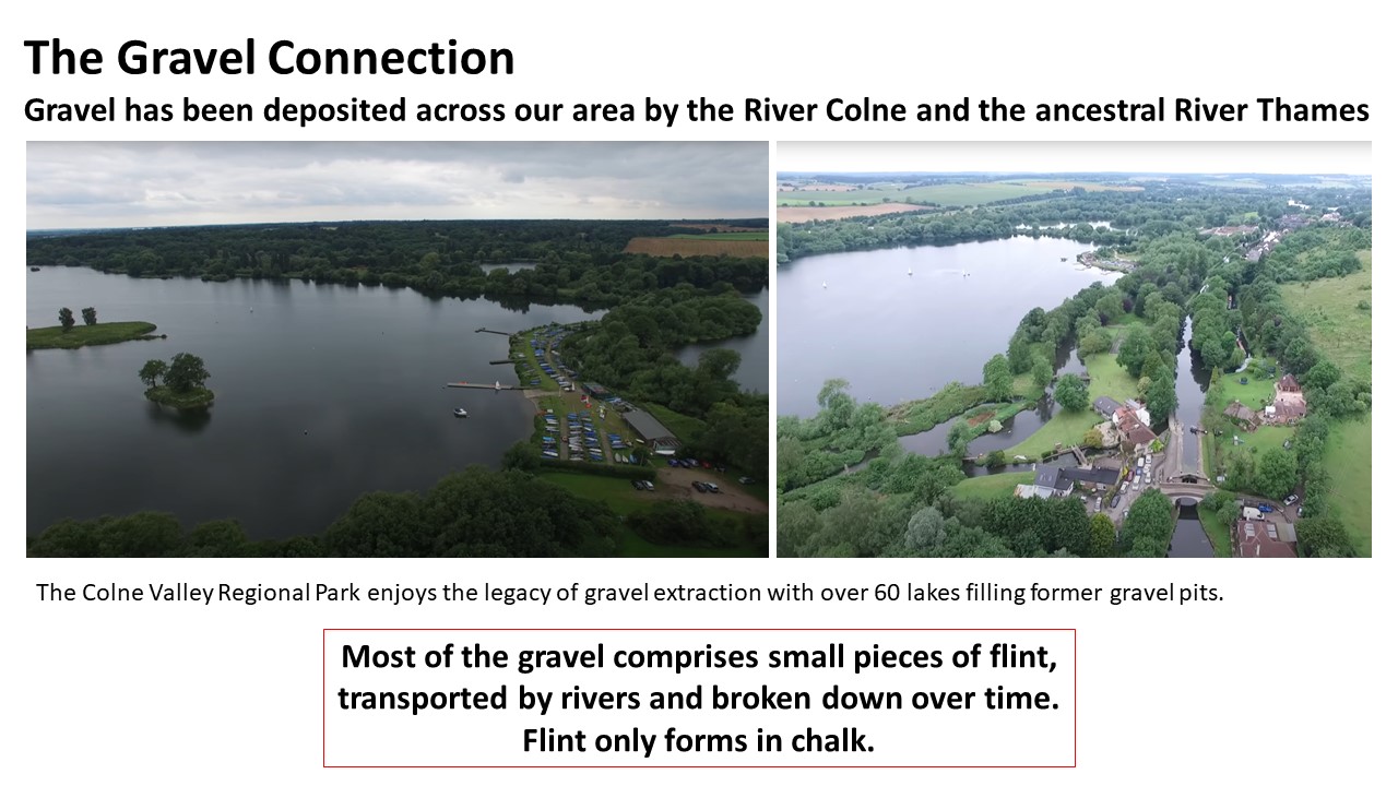
  • Gravel derived from the flint is an important resource for construction; deep deposits were left by rivers including the early Thames
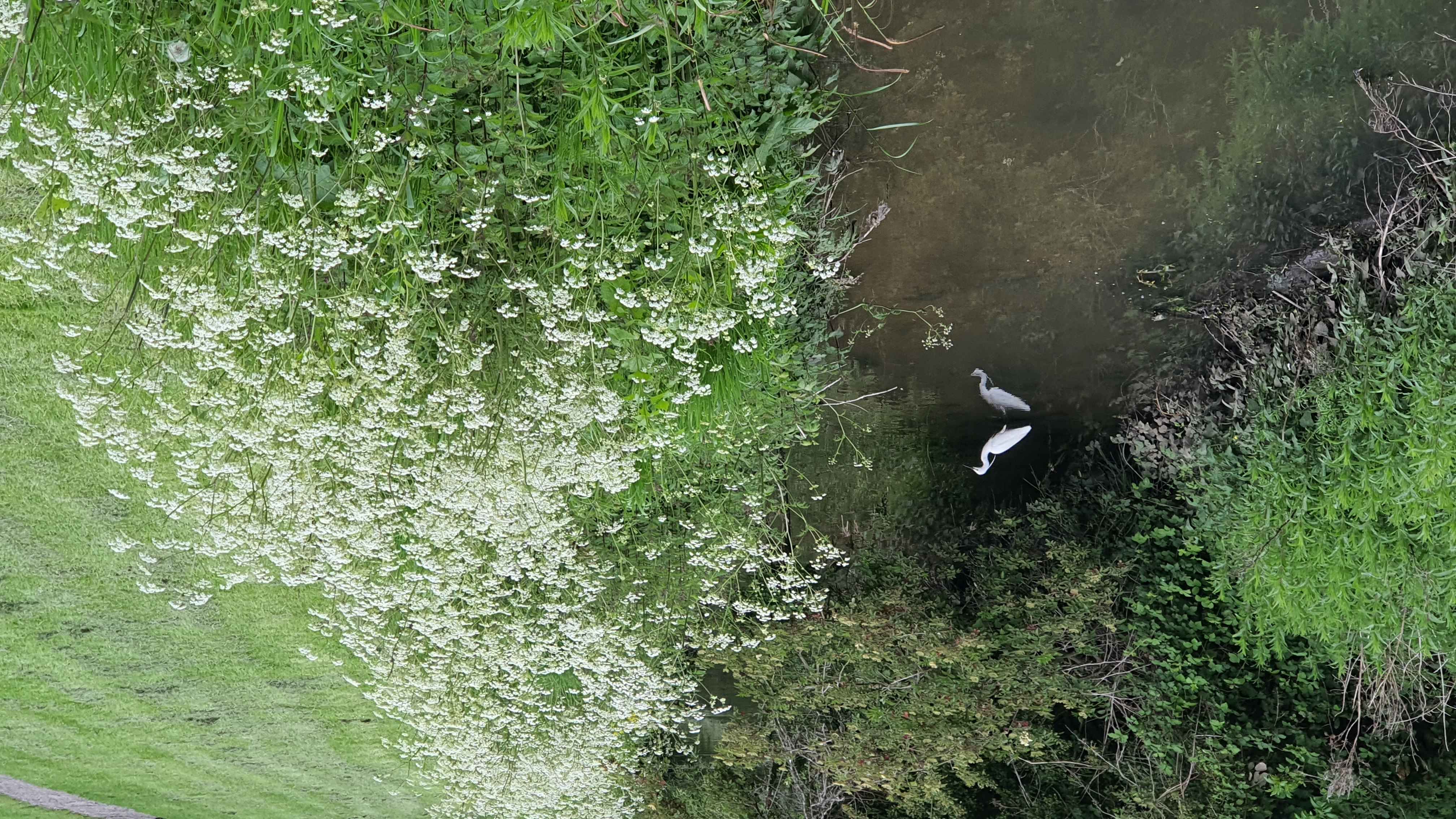
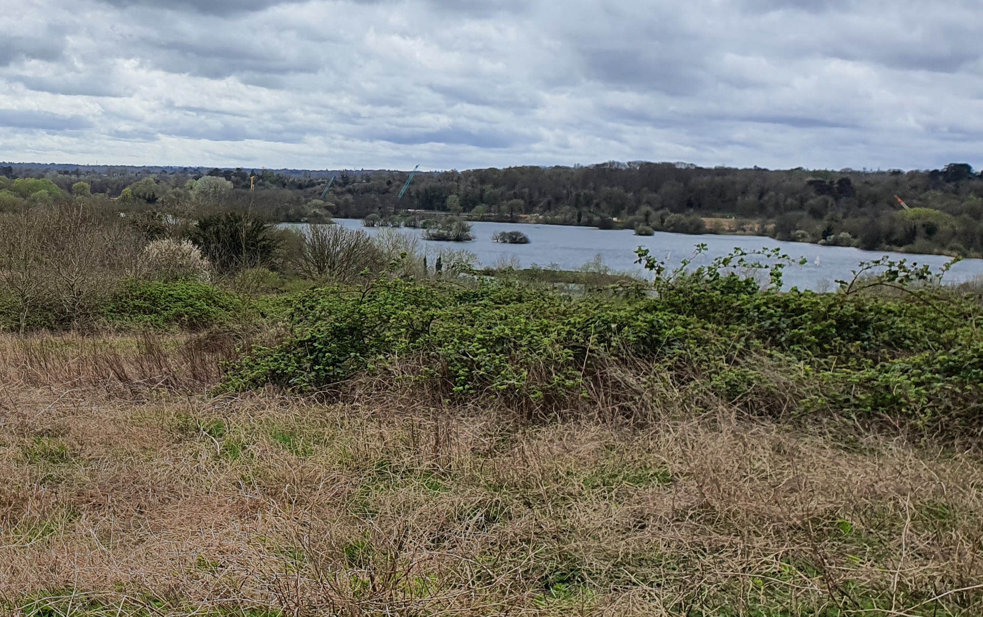
  • Former gravel pits and chalk quarries provide new wetland habitats
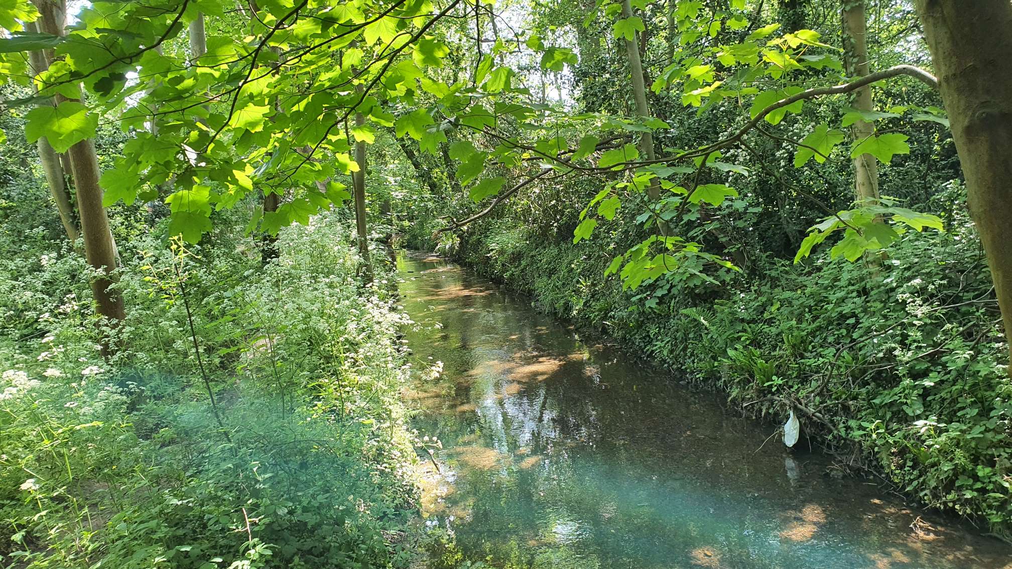
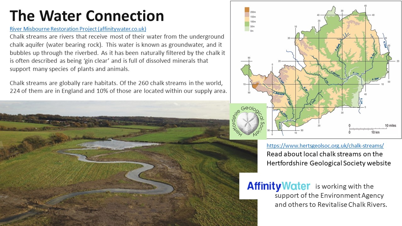
  • The Colne Valley rivers, canals and lakes form our western flank joining the Thames just south of our area
Local Geological SSSIs Stanmore Gravel Project Geodiversity / important sites Pretty Corner in Eastcote
Local Rivers Chalk Connections Pinner Chalk Mines (Ken Kirkman) #peoplelovepebbles on YouTube
Urban Geology and Building Stones Ruislip Woods Flood Management Local Industry (PDF download) Rock Stories
Local Rivers
Harrow and Hillingdon lie within the Thames basin and our local rivers ultimately drain into the Thames. To the west the Colne Valley Regional Park holds an important water system that includes 60 lakes and 200km of rivers and canals. The River Pinn is a tributary of the Colne; it rises in Harrow Weald and flows through Pinner, Eastcote, Ruislip, Ickenham, Uxbridge and Cowley. To the east of the Pinn, the Yeading Brook rises near Headstone Manor in North Harrow and is joined by another headstream near RAF Northolt. It becomes the River Crane from Cranford and enters the Thames at Isleworth.
https://check-long-term-flood-risk.service.gov.uk/postcode (HA2 6PX)
Yeading Brook
A tributory of the River Crane, Yeading Brook flows for 16 miles from Headstone Manor in Harrow, through Rayners Lane, Ruislip Gardens, Ickenham Marsh, Hillingdon, Yeading and Hayes joining the River Crane in Southall and finally reaching the Thames at Isleworth.

Parts of the Yeading Brook are prone to flooding. Check river levels here:
www.riverlevels.uk

Link to Crane Valley Partnership site
Link

Read more at London's Lost Rivers:
Link

Take a walk from Harrow to Ickenham along the Brook
Your Trails Link

Read about Yeading Brook Meadows - a London Wildlife Trust Reserve
Yeading Brook Meadows

River Pinn
The Pinn flows from the north of Harrow to the south west of Hillingdon where it joins the Frays River and consequently the River Colne at Yiewsley. En route it passes through Pinner (which shares its name), Eastcote, Ruislip, Ickenham, Uxbridge and Cowley, where it passes under the Grand Union Canal.


Follow the River Pinn along the Celandine Route from Pinner to Uxbridge:
Celandine Route

The Lost Byway walk (YouTube)

Envirnment Agency Pinn Flood Projects:
Follow Pinn Flood Projects

Thames 21 link:
Enhancing the River Pinn


River Colne
The River Colne flows south from Hertfordshire, then forms the boundary between Buckinghamshire and the London Borough of Hillingdon, finally joining the River Thames at Staines. For centuries, gravel and clay have been taken from the Colne Valley leaving a trail of large pits which are now lakes.

Together with the Grand Union Canal, the Colne is a major waterway in our region. Its story is linked to that of the River Thames and to the recent geology of the area.

Colne Valley Regional Park
Video: Yeading Brook at Ickenham Marsh
by Crane Valley Partnership
Video: the Celandine Route
by Ian Reid
Back to Local Geology
Flood Management in Ruislip Woods and Pinn Meadows
Site Visits To Park Wood and Pinn Meadows, 2021-22
Site Report by Allan Wheeler, available 9 Feb 2022
Clay, sand, gravel - Find out more. What is the Lambeth Group? Find out about Iron-oxidising Bacteria
Photos taken during site visit, 29 Jan 2022
flint pebble in clay leaky dams gravel in ditch Grub Ground Pond drainage Pinn Meadows ditch
In August 2021 we were contacted by John Scrivens of North Ruislip Flood Action Group and Ruislip Woods Management Advisory Group, asking for help to identify a geological feature in Ruislip Woods. Both groups had been collaborating with Hillingdon Council and the Environment Agency for several years to develop flood prevention measures in Park Wood. Large volumes of water flow out of the wood during heavy downpours of rain, putting houses that back onto the woods or the nearby stretch of the River Pinn at risk of flooding.

The feature of interest was a layer of compacted gravel in Park Wood, thought to belong to the Lambeth Group of sediment layers made up of clay, sand and gravel. A cemented layer of gravel from the Lambeth Group exists locally in Pinner, seen underground in the disused Pinner Chalk Mine.


In Park Wood, the compacted gravel, in a sandy clay matrix, can be seen along paths and watercourses where surface layers have been washed away by rainwater. It is known that Lambeth Group sedimentary layers are exposed in Ruislip Woods where the stream that flows into Ruislip Lido (a former reservoir built in 1811 to feed the Grand Junction, now Grand Union Canal) has cut down through the younger London Clay. What may be Lambeth Group gravels can also be seen nearby in the bed of the River Pinn. However, cemented layers like that in Pinner chalk mine have not been previously recorded in Ruislip Woods.

Why does it matter?
The Flood Action Group are trying to find out whether the hard, impermeable gravel layers might occur just beneath the surface in Park Wood. And if they do, could that explain why such large volumes of water flow out of the wood during heavy downpours of rain?
Thanks to John Scrivens and Stephen Heneker for the photos below:
Bacterial film Red colouration Geological map Stephen in ditch John, Allan, Grub Ground Pond
Back to Local Geology
Geodiversity: London and Local Sites
Harrow & Hillingdon Geological Society is proud to be actively involved with the London Geodiversity Partnership as a Member Group.
In our area we have TWO Geological Sites of Special Scientific Interest (
see Local SSSIs) at Harefield Pit and Harrow Weald.
MAP showing the Important Geological Sites of HARROW & HILLINGDON
full details on LGP website, link below
The above map is taken from the London Geodiversity Partnership interactive map of London. Click here for the full Guide to Important Geological Sites in London
London Geodiversity Partnership (external link)
What is Geodiversity?
Rocks, minerals, soils, landforms and topography, mountains, reivers and lakes - the non-living elements of nature that underpin every ecosystem and enable biodiversity on our planet.

Why is local geodiversity important?
This part of north-west London provides essential resources for building our city, such as brickearth and gravels for use in the construction of buildings and roads.

Major engineering projects in London require a detailed understanding of each site's geology, especially when constructing tall buildings and tunnels.

Geodiversity is the basis for the landscapes we love - rivers, woods, hills, wetlands.
Diana Clements Lecture: 13 April 22
Diana Clements is the author of the GA Guide to London and a leading contributor to the work of the London Geodiversity Partnership. In April 2022 she gave a talk on The Importance of Geodiversity Sites in Harrow and Hillingdon.

Diana has since become a member of HHGS and is actively involved with our Stanmore Gravel Project.

Back to Local Geology
Chalk Connections
Jon Noad's Chalk Fossils of Harefield
Local Chalk: Find out more


Read more about these Chalk Connections and more:
Find out more: Chalk Connections YouTube video: Introduction to Chalk YouTube video: Water Flow in Chalk
The Chilterns and Local Chalk
Meeting - 9 March 2022
The Geology of the Chiltern Chalk and the impact of HS2.
Talk by
Dr Haydon Bailey, Geological Advisor, The Chiltern Society and Chairman, Hertfordshire Geological Society.

March talk by Haydon Bailey Chalk Streams (Hertfordshire GS)
Back to Local Geology
Urban Geology and Building Stones
Have you noticed amazing fossils of ancient sea creatures in the floor of Uxbridge Shopping Centre?
Take a walk in our area - download a PDF below for some easy to follow geological highlights to be seen as you walk along:
Uxbridge Building Stones Walk Pinner Building Stones Walk Pinner - A Geological Trail
Downloadable resources
Climate Change in our region:
To coincide with COP26 in November 2021, we took a closer look at the rocks of Harrow and Hillingdon for the GA Festival of Geology. Download the PDF here:
Evidence of past climates from local rocks
Hillingdon Chalk Fossils
Download the PDF here:
Fossils of Harefield (by Jon Noad)
Geological Sights! London and the South East:
For the GA Festival of Geology 2021 we created a series of downloadable presentations called Geological Sights! The geology of our region is explained using photos taken from HHGS field trips.
Download the PDF here:
Geological Sights! London & Southeast

Ruislip Lido (photo by Liz Chiu)
Rock Stories
READ THE FULL STORY HERE

www.gov.uk 2018 NEWS: HS2 workers discover ancient coastline in West London
Chalk+Flint

Pinner Chalk Mine
Pinner Chalk Mine
See
Chalk Connections
Chalk from Harefield Pit
Chalk from Harefield Pit SSSI
See
Local SSSIs
Gravel/Sand

Harrow Weald SSSI (GLA18)
Diagram showing gravel terraces left by the River Thames
Harefield Pit SSSI (GLA34)
Reading Formation sands at Harefield Pit SSSI
Stanmore gravel at Harrow Weald Common
Stanmore Gravel at Harrow Weald SSSI
(see
Stanmore Gravel Project)
People Love Pebbles
Silt/Clay

Yeading Brook, Ickenham Marsh
Clay in Yeading Brook, Ickenham
London Clay exposed in the banks of Yeading Brook, Hillingdon
Concretions

Hertfordshire Puddingstone (Uxbridge Rock Show Exhibit)
Hertfordshire Puddingstone forms a hard layer above the chalk in Pinner Chalk Mines, which protects the tunnels from collapse.
Sarsen stone at Monor Farm, Ruislip
Sarsen boulder found March 2022 while digging a pond in Ruislip Woods
Back to Local Geology
HHGS at Pretty Corner, Eastcote